I recently drove up to participate in the USA Hike & Fly’s Ojai race on October 31st, both as an athlete and a provider of tracking with Helium. The athlete side was fun, but expensive. I landed in the bushes and tore up my wing enough to warrant buying a new one. Not cheap. Still, rad to blast up the backside of the range then launch off the ridge in an attempt to fly the course instead of hike it.
The other reason I went up was to provide custom tracking for race participants. Having recently done the very first paragliding tracking event up in Utah, for the X Red Rocks race, I managed to avoid a few mistakes, repeat a few more, and learn a ton about how best to run tracking for people who move fluidly from earth to air.
As a quick recap, a “hike and fly” race is one where you attempt to complete a course by hiking on the ground or flying your paraglider. Typically these races start in a valley and you hike up to the top of a mountain or ridge, then launch off from the high point and tag other points, either in the air or on the ground. These “points” are usually cylinders of various sizes, from 10m radius to a 5 km radius.
Ok, so what does it take to track a paragliding race with Helium?
Let’s start with the prep work. With 30 participants, I wanted to have more than enough trackers ready. My wife Lee & I prepped 40 Digital Matter Oysters, which were originally designed for vehicles but work well enough OTS (Off The Shelf) for paraglider tracking. Here they are after we’d gotten stickers on ’em, labeled ’em with a useful number, and put the GKI contact info on the back, in case anyone forgot to return theirs at the end of the day.
Yes, I used a driver to pull the back plates off all of ’em. At 6 screws each that would’ve taken forever manually.
The next step was getting up to Ojai, where the race would be held. Lee & I loaded up the truck and headed north, arriving in the evening at The Hummingbird Inn. The next morning I laid out all my gear for initial function checks. So far, so good.
One thing I was doing as a test run this time was running a mobile hotspot, Late Rainbow Bee. I built a Data Only Hotspot using directions over on the Helium site and using a Dragino LPS8, a RUT240 cell modem, and small Goal Zero Yeti 200X battery I had laying around from another project. On this project I wasn’t able to get it to pass data via the RUT240, so work remains to be done. Probably an issue with the RUT240 setup. Still, that in and of itself has been a fun little project. Ok, onward!
I rallied fellow San Diego pilot Kris Souther to head up with Lee & I to place the two GKI Hotspots, Atomic Blood Wolverine & Fierce Honey Badger. We bumped over a bunch of dirt roads together and got everything sorted out.
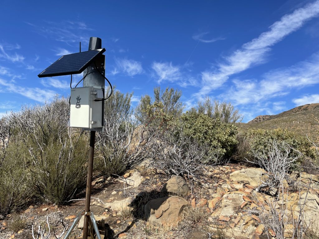
Here’s the Badger over by Chief Peak. For those of you way into building these things, this is a slightly older build mode (directions here). Notice the RP-SMA connector (not an N‑type) for the bulkhead connection. N‑types are way sturdier. That’s 3′ of LMR400 cable, a 30 watt panel, and a 20 Ah battery. Oh, and of course, an HNTenna.
Once the Badger was up we drove the long and rough road over to Nordoff, which had stunning views, a fire observation tower, and a paragliding launch.
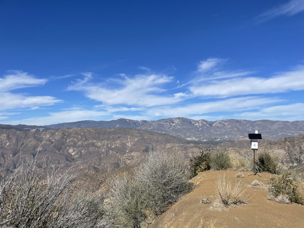
I set up Atomic Blood Wolverine on a flat spot with giant views, and our work was done.
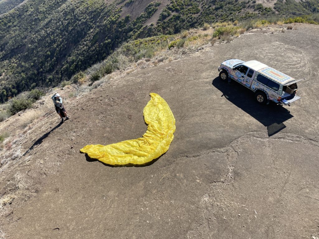
Kris brought along his wing, and once ABW was up, laid out his wing and launched off Nordoff Peak.
Lee & I drove back down, and I checked in on my two hotspots to make sure they were running. One wasn’t, most likely due to no cell signal. One of many lessons learned was to make sure I check the function of the cell modem and the hotspot BEFORE leaving the thing up and running.
I spent the rest of the afternoon checking and re-checking all my trackers, needing to shake a few of ’em to get them to connect (movement triggers a radio transmission). Tommy over at LoneStar Tracking was super helpful walking me through basic troubleshooting processes, and by the end of it I had all the units I needed for race day.
Lee & I got up early Sunday morning and drove over to the meeting point to hand out trackers. I gave a brief overview to the racers about what was happening, what Helium was, and the benefits & shortfalls of a custom deployed LoRa tracking system, then I turned off “Gristleking” mode and went into athlete mode. Here’s the start line down on Rose Valley Road.
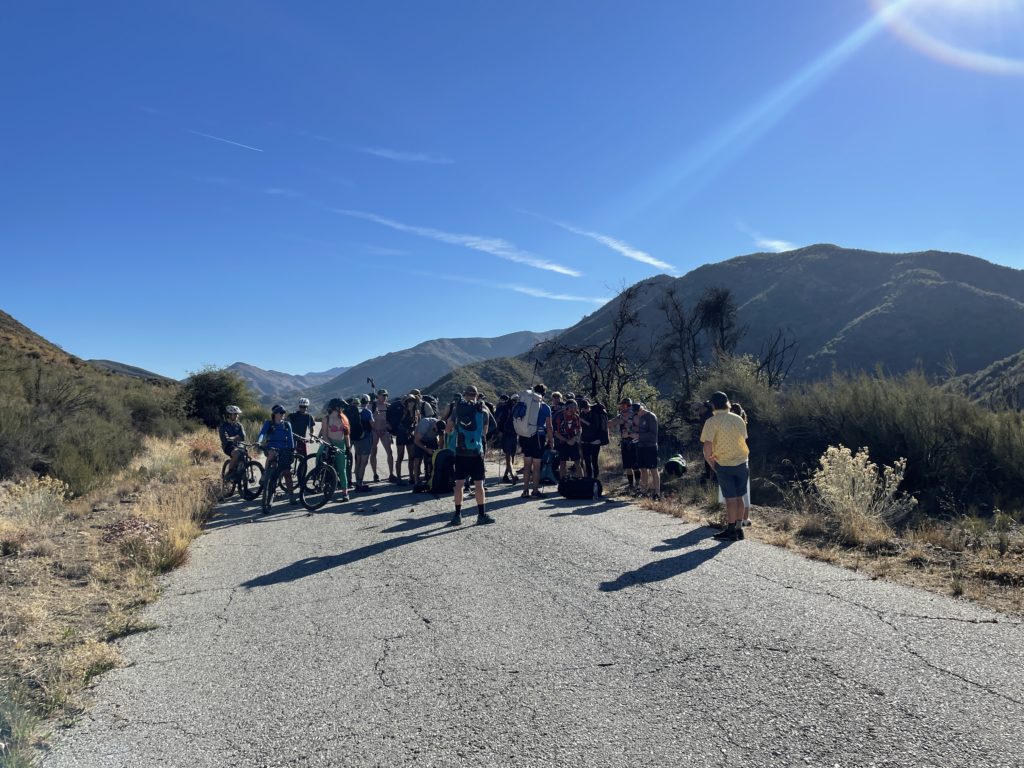
We had a couple of mountain bikers as part of it, they biked the whole thing, which was pretty cool. A few of ’em even carried trackers!
From there it was a straight grind fest to gain the ridge, including some off-piste action within minutes of the start when we missed our turn off. That’s how adventures go, right?
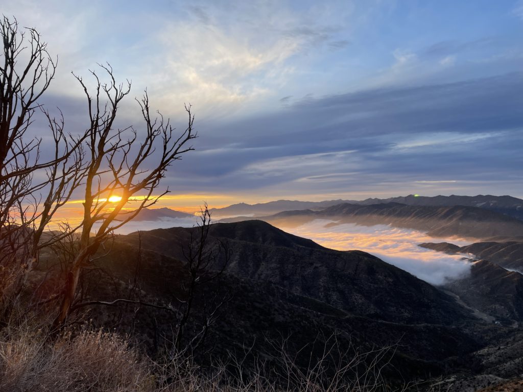
After managing to land in thick brush unscathed and yet tear up my wing so badly I needed to buy a new one, I packed it all up, hiked down 6 miles down Gridley Trail to meet Lee, and we drove around for almost 4 hours picking up the hotspots back in the mountains. Dirt roads are slow going! The sun was setting and the marine layer was rolling in fast as we came back down the mountain.
Lessons Learned
- easier way to power cycle the trackers is needed, both to save battery & as a function check
- always check a remote hotspot BEFORE walking away from it
- the Data Only Hotspots are a neat idea but require a fair amount of geekery to get going
- without cell signal (or some kind of internet connection) your hotspot won’t be useful
- simple method of having a written chart to keep track of (no pun intended) who got what tracker worked really well
- it takes a ton of time to get to some of these places. You probably want to be on site at least 2 days early
- prior map study and thinking about coverage is essential; need to shift out of “High Earning” mode and into “Best Coverage” mode
Hope that helps YOU as you deploy and use the Helium Network. Here’s to all of us growing and crushing it together. Rock on!
Leave a Reply