Our pilot project is complete, and boy have we learned a ton from this one! While many are still focusing on earning HNT for Helium Hotspot deployments, the obvious move for those of us interested in longevity is actually USING the Network.
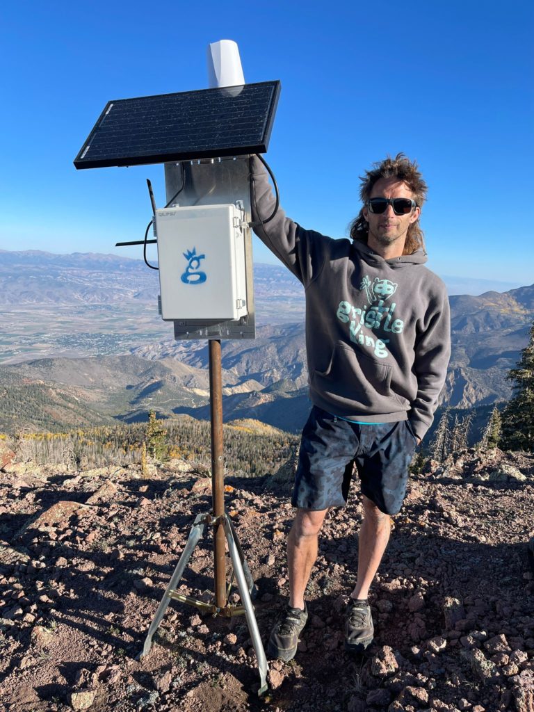
Over the course of a week, supported by Tommy and Ryan at Lonestar Tracking, Matthew at Digital Matter, Travis at Helium, and Jeremy C (@jerm on Discord), I deployed 2 off-grid Helium Hotspots high in the mountains of Utah (one at over 8,000′ and one above 11,000′) to track 30+ paragliders as they flew during the annual Red Rocks Fly In as well as raced during the inaugural X Red Rocks Hike & Fly race.
I’ve written about the prep for that here, as well as how paragliding got me into Helium. For now, let’s follow along with what it looks like when you actually deploy Helium Hotspots for real world usage.
It started with the usual last minute scramble to get everything ready for a big project. The night before I was out in the shop cutting masts and prepping enclosures to make sure I had everything ready for a big week! During the past year, I’ve learned a bunch about getting these things out in the wild. The latest improvement I learned from a client (thanks Dave H!) was using these little tripods for a “plant it anywhere” setup that’s easy to carry.
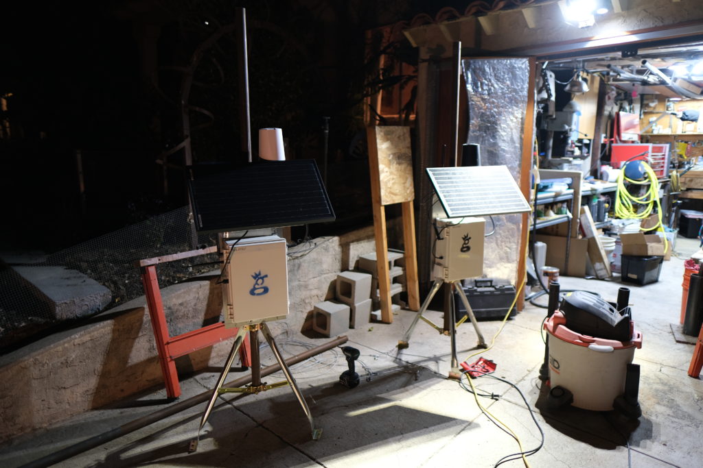
When you get where you’re going, just fasten the tripods into the ground with long lag bolts and you’re set!
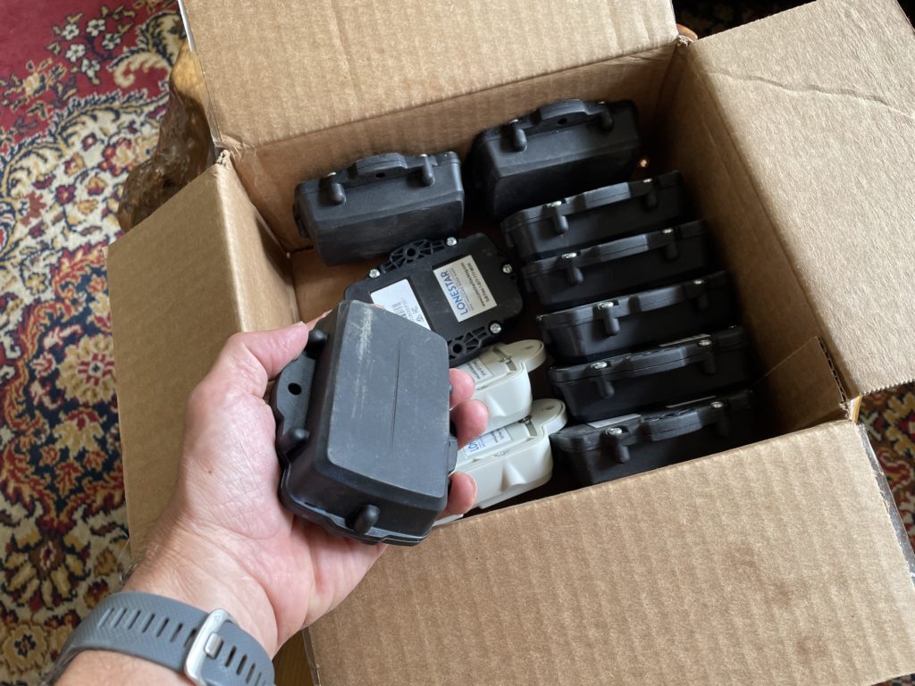
The trackers I used were Digital Matter Oyster trackers, about 160 grams and the size of a few phones stacked on top of each other. The advantages these trackers have is that there aren’t any buttons to turn off or on, the battery life is measured from weeks to years, and they’re pretty rugged. Originally designed to track vehicles, they were an excellent step in the direction of tracking far less predictable things. A paraglider has the entire sky within which to move.
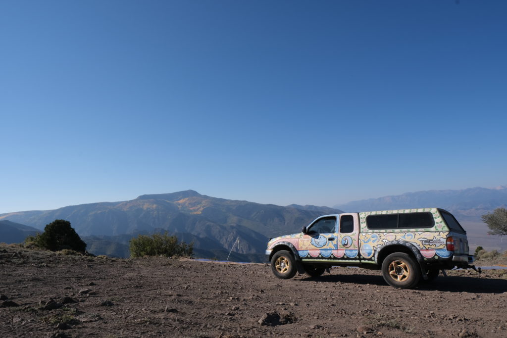
I arrived late Friday night into Monroe, Utah, then met up the next morning with Stacy Whitmore, president of the local flying club, CUASA. We jumped in my truck (which is pretty easy to pick out in a crowd) and headed up to place the two Helium Hotspots, one at Cove Launch, and one on top of Monroe Peak.
Cove was first up, and after a 40 minute drive up a rough road, we arrived at a truly glorious place to put a hotspot. With a view of the Sevier Valley to the north and south, it was an excellent first step.
As you can see in the video above, these 2 hotspots weren’t the only ones providing coverage. Since pilots can get up to 18,000′ (the legal limit) the trackers have a clear line of sight..everywhere. We were seeing 80+ mile sensor communication to the gateways, which is impressive!
With the gateways set up, it was time to start flying!
As I handed out trackers to paragliders and watched their progress through the sky, a few things became clear.
First, the Network works. While the tech can be complicated and the whole thing is not yet push-a-button easy, it does work. That’s rad.
Second, the deployment pattern of Hotspots becomes far more important when you start to optimize for Network coverage and not just earnings. I jumped at the first two locations because both were high and had great views. It worked, but there were plenty of coverage holes that I could’ve filled in with a different pattern. When I cover this event next year, I’ll use 2 or 3 more hotspots and place them in a ring around the valley rather than on just one side. I’ll also use Kudzu to estimate coverage, which was something I’d wanted to do but ran out of time.
Third, using vehicle trackers to track paragliders is an excellent start, but free flight pilots in general (paraglider and hang gliders) need a few options that we hadn’t configured in the trackers. Here’s an example of the day in the life of a tracker, from the time I handed it out in the LZ (landing zone, which is where pilots in Monroe usually meet to start the day) all the way to the end of the day when the pilot went back to their hotel.
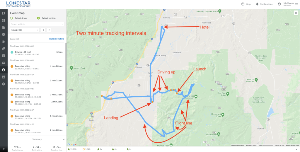
Before going further, I want to make it clear that this was a pilot program. This is NOT what the end product of a free flight tracker will look like. The goal of this project was to see what was possible and where we needed to improve.
Most of the improvements can come from better Hotspot placement and configuration settings within the tracker. Some improvements specific to free flight will come from hardware modifications. We started off with 2 minute intervals and eventually got ’em down to 30 second intervals by the end of the week. While that pushes out more *potential* data points, if you don’t have coverage from a Hotspot it doesn’t matter how much data your sensor is pushing out; it won’t get seen.
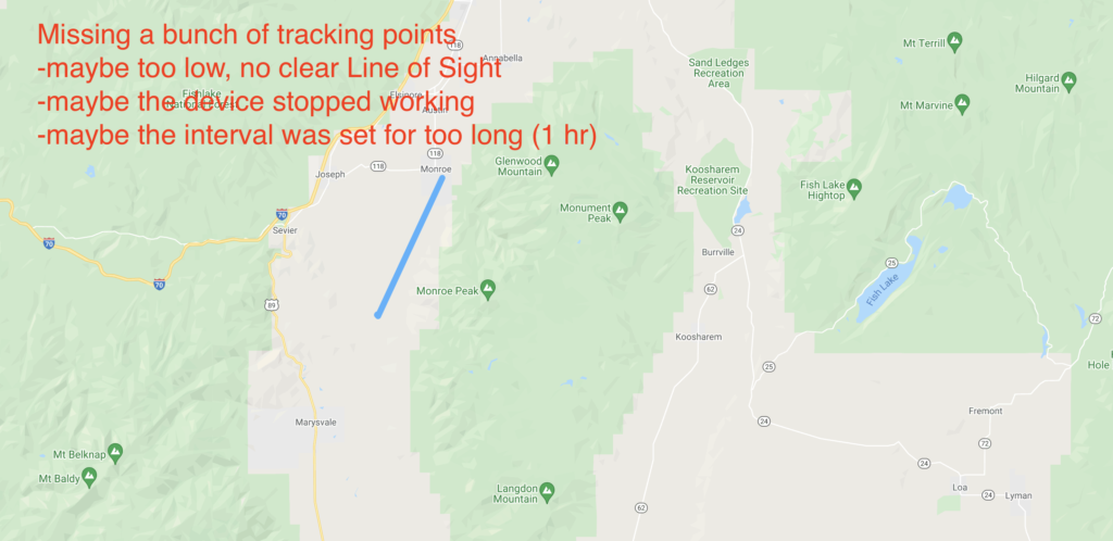
A bunch of things can go wrong. The interval is important; if you set it for an hour you’ll have a battery life measured in years, but for a 2 hour flight you’ll only get 2 data points, like this:
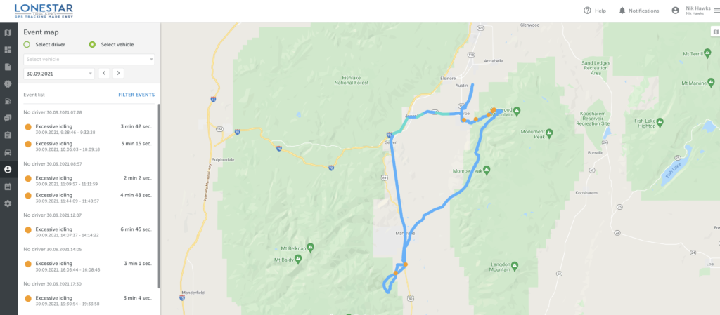
Here’s another pilot who did that same flight but had a tracker with much shorter intervals. You can see the difference it makes!
The configuration settings presented an additional set of challenges. For paragliding, I wanted a tracker that could be found if the pilot either had an emergency and landed conscious (and able to push a button), or landed and was unconscious. These trackers were set up for long battery life, so once they stopped moving for a period of time they went to sleep. That’s very useful for tracking vehicles on land, but not very useful for paragliders flying in adventure country.
Keep in mind that these trackers only report their positions if they can communicate with a Hotspot. No Hotspot, no comms.
Going to sleep once movement has stopped presents the issue of not being able to be found if a pilot crashes and is unconscious or just not able to move. The solutions for solving that could be creating an on/off button for the tracker so that you can conserve battery at home, when you don’t need to be tracked, but push out signals every 2 minutes when you go flying.
The rad aspect of creating off grid Helium Hotspots is that you could put a Hotspot in a helicopter and fly a search pattern with a very wide “bubble” of coverage. As long as trackers are on and pinging, you’re very likely to find them. This creates another potential solution for “crash detection” in trackers where they’d continue to ping at 1 or 2 minute intervals if they detected a sudden stopping of movement.
Finally, this project brought to light the usefulness of an “emergency” button, just like you have on an inReach mini.
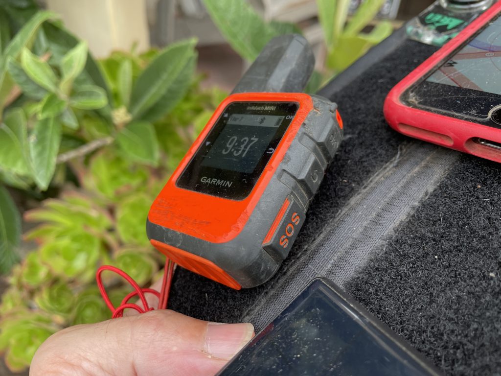
You might ask, “What’s the point of having another device that does the same thing?” Well, there are three good reasons. First, when working in high consequence environments, a basic rule of safety is “Two is one and one is none.” Having a backup can be the difference between being found within hours of a crash and not being found for days.
Second, because these two devices work using different technologies, they offer a wider spectrum of “findability.” While an inReach can be found by communicating with satellites, if it’s deep in a canyon and doesn’t have a clear “view” of a satellite, it becomes less useful. A LoRa tracker, on the other hand, puts out an omnidirectional beacon at a minimum range of 60 meters in dense brush and a max range of 80+ miles with clear line of sight. A helo carrying a mobile Helium-compatible Hotspot can fly around and provide a bubble of fairly focused coverage, greatly speeding up the tracking possibilities.
Third, as gruesome as it sounds, if you auger in and hit hard, the impact is likely to break not only your bones but also the electronic tracking devices you’re carrying. If those electronic devices are on opposite sides of your body, it is more likely that at least one of them will not bear the full force of the impact and will remain trackable. I know, ugly and terrible, but also practical.
Practicality is the watchword here. The long term health of the Network is based upon the usability of it. Projects like these, where we put sensors and gateways (Hotspots) out into the wild and see how they do, go a long way towards all of us leaning how to use this fantastically cool technology to improve our lives.
If you’d like to see the presentation I gave at the 2021 Red Rocks Fly In about Helium for paragliders, here it is:
My entire involvement with Helium started with a lost paraglider, but finding lost paragliders is just a beginning. I am super pumped to be on this journey and to share as much as I can with you, so that together we can build a superbly useful tool for whatever problem you want to solve. Here’s to safe flying, to useful Networks, and to advancing our knowledge and understanding that this giant new realm of IoT opportunity available to us all.
To life!
Resources
Feel free to reach out to any of these companies for help with your projects, and of course, tell ’em the Gristle King sent ya! 🙂
Lonestar Tracking - Based out of Texas, Lonestar makes it super easy to buy devices and start tracking whatever you’d like.
Digital Matter devices
CUASA — Central Utah Air Sports Association — If you have hotspots you want to place off grid, this crew is way open to having you put them up on high sites around the Sevier Valley. Reach out to Stacy or Jeff to see if you can work with them.
If you’re looking for work in the Helium ecosystem, please check out this rad project I’m a part of called Helium Jobs. You can post and find jobs there, help support the ecosystem by making it easier to connect professionally, and let the world know that YOU exist and want to help contribute within the Network. Rock on!

Leave a Reply